OTD August 1 for #Blaugust2025
I loved Birming’s idea to include an “On This Day” photo during #Blaugust2025, so I’m going to do the same. I doubt I’ll be able to keep this up every single day of the month…
But today I’m feeling some extra motivation, so I’m going to do yesterday’s post, and aww hell, I’m even going to put an OTD photo from every year that I have in my iCloud library.
Let’s get started!
EDIT: Oh boy, there’s an especially fun story about halfway down!
—
Aug 1 2024
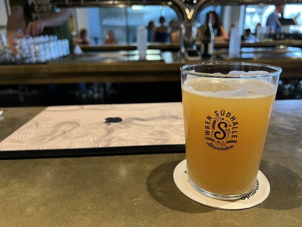
Looks like I found myself at our local watering hole, likely doing some trip planning. Funny enough, that’s where I’m posting this from.
Aug 1 2023
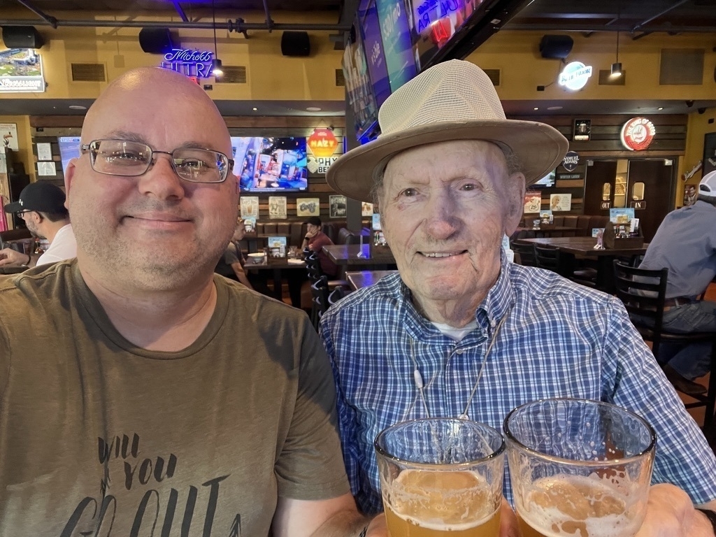
It looks like we flew somewhere later this night, but beforehand I wheeled my dad out for a goodbye beverage at the local bar I brought him to when he was in assisted living.
Aug 1 2022
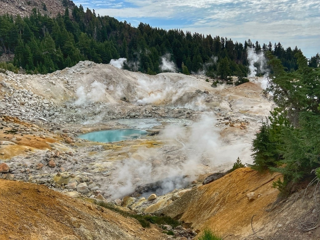
After our last night of camping in the park, we spent the morning hiking to Bumpass Hell, a thermal area in Lassen Volcanic National Park in Northern California. It’s perhaps my favorite official placename in the entire national parks system.
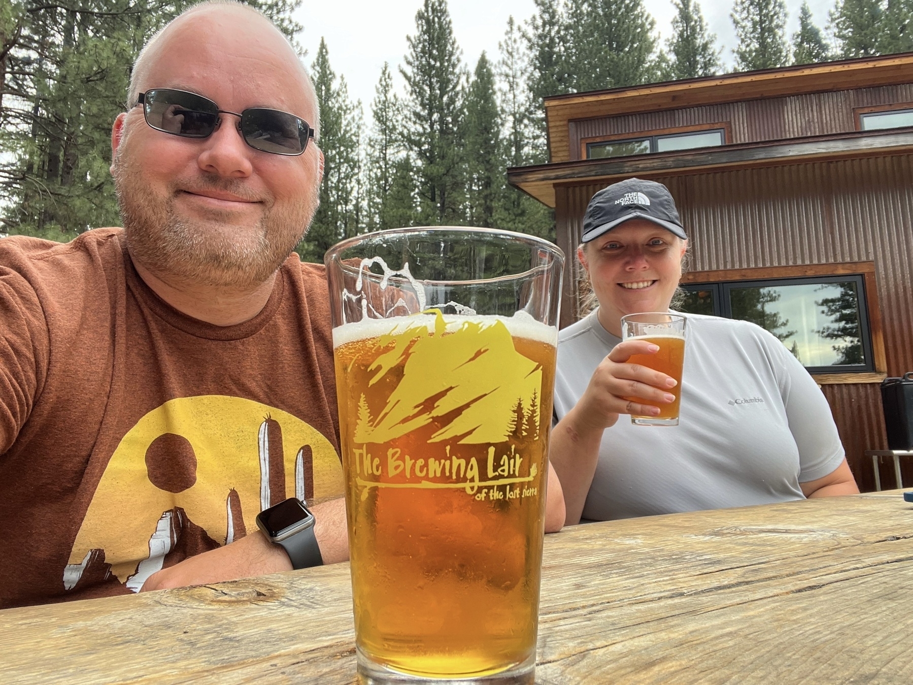
Leaving the park, we stopped for lunch and a beer at The Brewing Liar, a very interesting brewery tucked away on its own plot of forested lands. It’s a rather unique place, complete with hiking trails, lots of outdoor seating area, and a self-guided brewery tour.
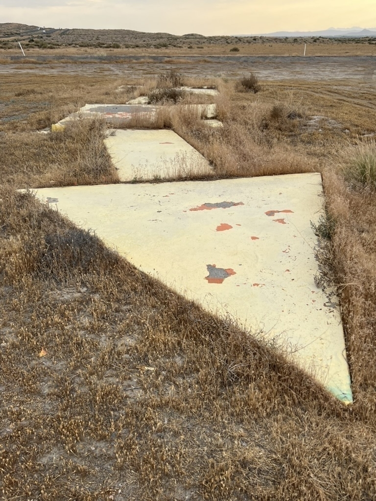
We then drove over Beckwourth Pass for our Sierra Mountain Passes quest on our way through Nevada, where we stopped at one of the concrete arrows that was once part of the Transcontinental airmail service (here’s an excellent database of them). We stayed in Winnemucca that night, in part to mark off the place while I considered whether to adopt a quest to visit all the locations mention in the song I’ve Been Everywhere.
Aug 1 2020

I published my first book that week—The Complete Guide to Kayaking the Salt River—and gave it away for free for the first few days to generate some buzz. It was kinda fun to check in that next day to see it listed as the #1 free book in Amazon’s Adventure Travel category. I only promoted it to some friends and posted it in two Facebook groups, and never since, and it’s somehow still in the Top 1000 adventure books—even though I also give it away for free on my website. Last I checked, there were a dozen of AI-generated scam knock-offs that are clear re-writes of my book (same page count, all with photos of other rivers and obviously fake author names).
But that’s ok, I never wrote it for the money. The primary goal of this “covid project” was to test a theory I had for how to build a series of locally-based public lands stewardship & advocacy groups, wherein you could organize people to join a conservation group in exchange for a free guidebook on the place and activity in question. Essentially, I wanted to know if you could use a “lead magnet” marketing technique to quickly build a constituency that could push back on an impending policy attack or bad proposal. The answer, I discovered, is yes: the “Alliance of Salt River Paddlers” quickly surpassed my subscription goals, even without any additional effort besides publishing the original guide and website.
These were still covid times, so apparently I attended the virtual convention for the National Park Travelers Club later that day. Man, I forgot how many things we all attended virtually that year. It would have sucked to have completed a big life goal and then to just get your lifetime achievement award via Zoom.
Aug 1 2018
Whew, what a crazy day this was. I really need to write up this story in full detail. But here’s the short-ish version.
We were up in Alaska, attempting to visit a bunch of rather remote national parks and conservation areas for my parks quest. One of them is Yukon-Charley Rivers National Preserve along the Alaska-Yukon border. We had chartered a small bush plane to get us there; an expensive proposition, but that was the best we can do for such a remote park unit given our time constraints.
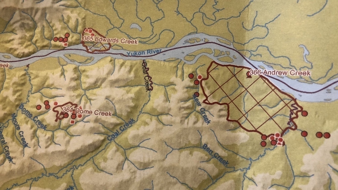
The night before the trip, we noticed that there were a number of wildfires in the area, including three directly surrounding Coal Creek, the area that we would be visiting. I assumed that the flight would be canceled, but receiving no notice, we showed up the next day anyway. The young, headstrong pilot apparently hadn’t checked and was unaware of the wildfires. I asked him about it, but he shrugged off my concern as that of a nervous tourist, probably someone who had never been in a small plane before and was looking for an excuse to bail on the flight reservation.
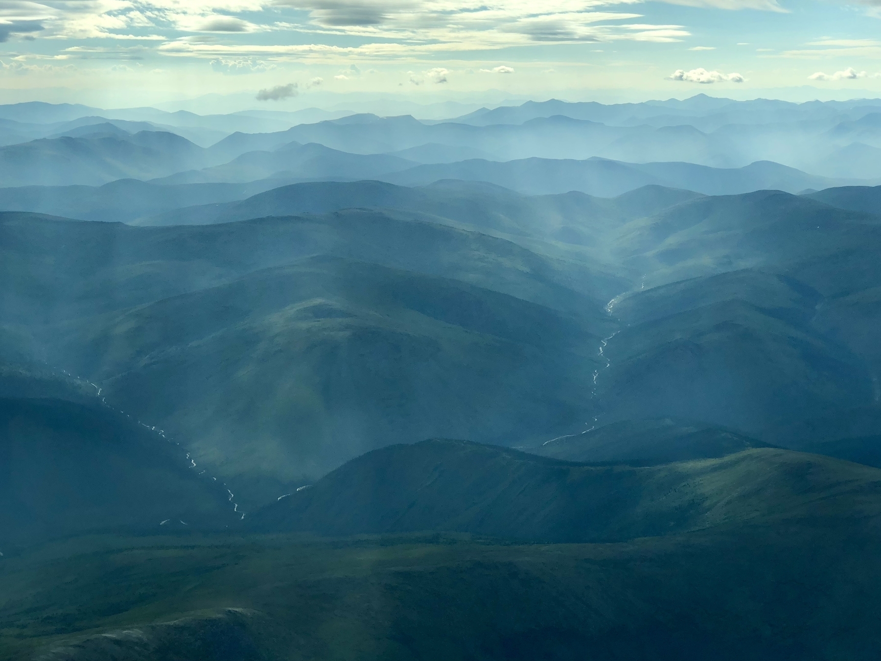
He assured us that he was going to get us to Coal Creek (perhaps whether we wanted to or not). The first portion of the flight featured some wildfire smoke, but nothing too bad—it really added to the beauty of the mountains and valleys.
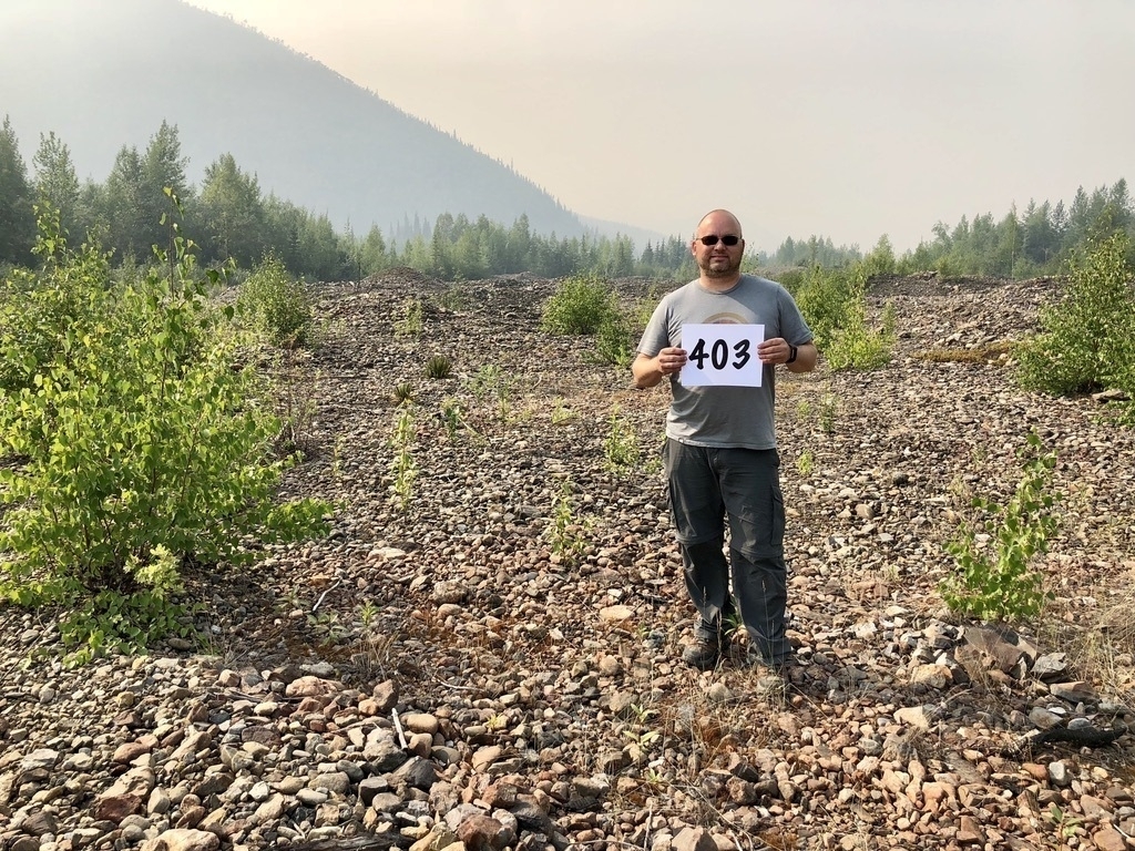
The smoke got thicker and thicker, but we managed to land at the gravel landing strip in Coal Creek nonetheless. And I, per tradition, took my traditional “sign photo” indicating which park unit this was on my quest. ☑️ Check!
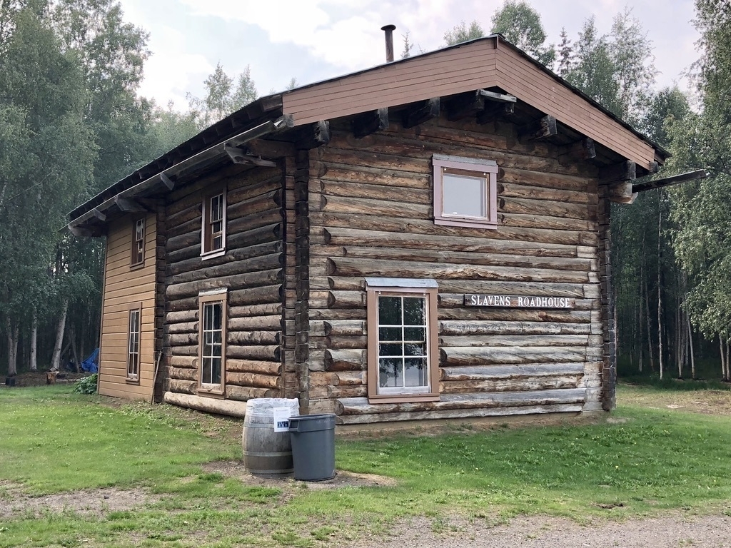
We only had about an hour on the ground. That would give us enough time to hike about a mile up the trail to the historic mining camp cabins at Coal Creek Camp, but not enough to hike the four miles down to see the dredging machinery on the way to the Yukon River, where the historic Slavens Roadhouse is—perhaps the highlight of the park.
My buddy Brian and I hiked up the trail towards the historic camp, leaving Jen at a stream crossing about halfway. We arrived at the grouping of cabins, intent of getting an official park stamp for our effort. There were firehoses everywhere, apparently positioned to water down the wooden structures if the wildfires converged closer.
We wandered into the cabin where the park stamp is located, and were immediately questioned.
“Who are you? How did you get here?”
“Oh, we’re here for the park stamp,” we explained. “We just flew in to Coal Creek.”
“Your pilot landed? We can’t even get our fire crew to land right now.”
We discovered that the park had indeed been closed, and the folks we were talking to were part of the interagency fire team sent in to coordinate the fire response and hopefully protect the historic buildings.
The fire commander asked if we were going to Slavens Roadhouse. We said no, we sadly didn’t have enough time. She said, “Look, you can’t come here without getting there. I’ll take you. Don’t worry, I promise to get you back before the pilot leaves.” She delegated responsibility for two of the fires to others in the room, and we followed her out to a side-by-side.
She drove like a bat out of hell back down the trail we had hiked, slowed almost to a stop so Jen could get on, and barreled our way down to the river. We got a quick tour inside the 1930s roadhouse, one of several along the Yukon River.
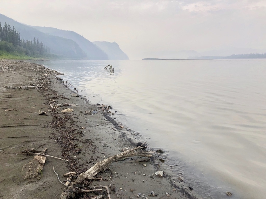
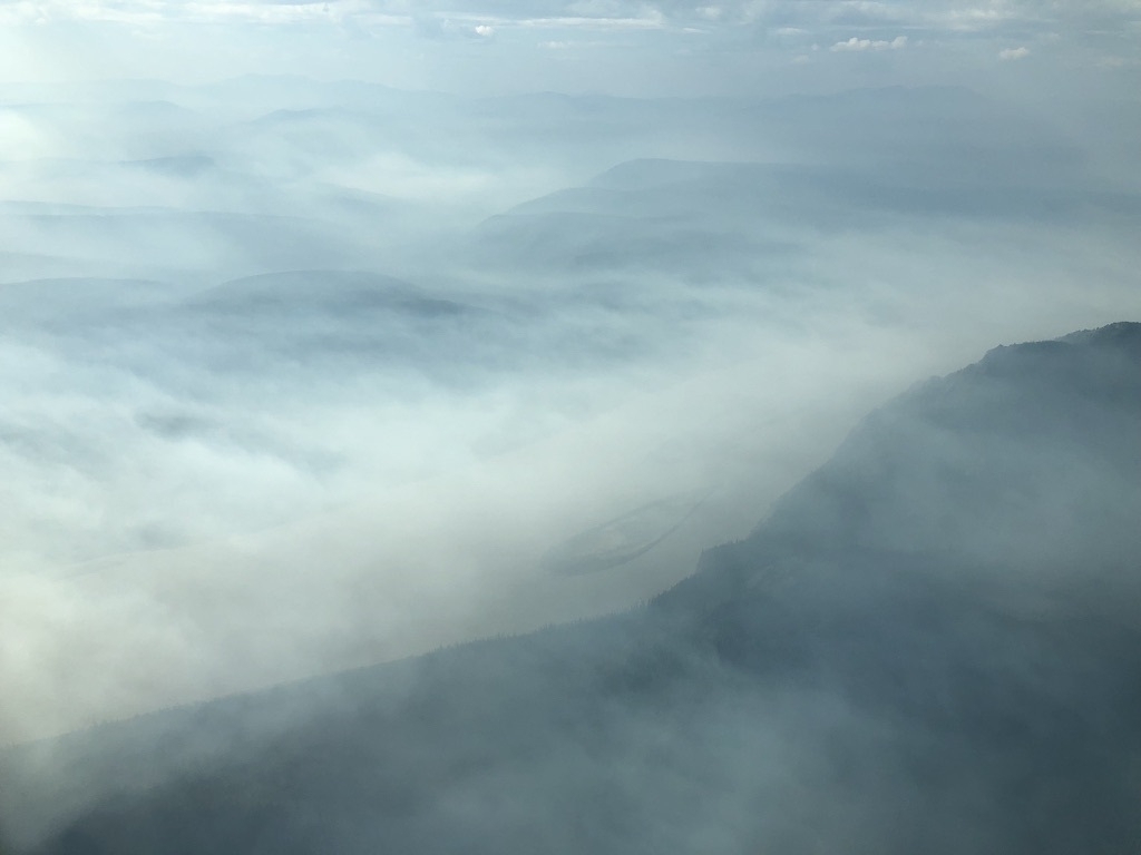
We took a few photos along the smoke-filled Yukon River, and then headed back towards the plane, stopping briefly to inspect the old dredging operation between the river and landing strip. We arrived two minutes later than expected, which was fine as the pilot was off in the brush for some bushy-bushy. Satisfied that we had accomplished our goal, we took off. Jen quickly fell asleep while I took reflected on the crazy hour we had just spent.
It didn’t take a long for the tension to build inside the plane, however. The pilot was struggling to find a suitable path amidst all the wildfire smoke (there were two other wildfires nearby, so he was dealing with the smoke from 5 different fires, plus low clouds). Bush planes aren’t like commercial jets—it’s line of sight, so you can’t just fly through clouds and smoke. This was quickly becoming a tricky situation.
The pilot gained altitude, then lost it, circled around for some time, and tried a number of options before so forth. By now, the mood was now very tense. Jen woke up and immediately sensed that there was something wrong, grabbing my arm with a death grip. She saw that I had been marking possible emergency landing spots on the gps topo map app I was running—there were very few.
Eventually, the pilot noticed a possible escape route, banked hard, then pointed the nose up and just gunned the engine. I’m not sure what the tachometer must have said, but it sure as shit sounded like it was in the red. We climbed towards a mountain face, engine screaming for minutes, as clouds quickly pushed together. These few minutes were amongst the most tense moments I’ve had, wondering if we would both make it over the mountain (we did, of course), and in time before our path was blocked. We crested the ridgeline into a broader river valley, and in a few minutes came across a remote dirt road. We finally relaxed a bit, knowing that we had a landing spot, if we needed it. Whew!
We returned to the airport in Fairbanks more than two hours later than scheduled, just before a big front weather hit that airport, too. “Well, we made it back,” our pilot finally said, breaking the hours-long silence of the return flight. We all gave an appreciative laugh at this, an understated way of saying “look, we didn’t die.” His girlfriend was waiting just off the runway for us. As soon as we came to a stop, she jumped up into the cockpit for an embrace. We obviously weren’t the only ones who had been nervous during the flight.
We unloaded ourselves and walked to the office, where we subsequently waited for 45 minutes before the pilot finally entered with the flight plan, which we needed to calculate and pay our fees. Unfortunately, I don’t have good photos from the flight back, as we were too focused to play tourist. But hey, we marked off the park I needed.
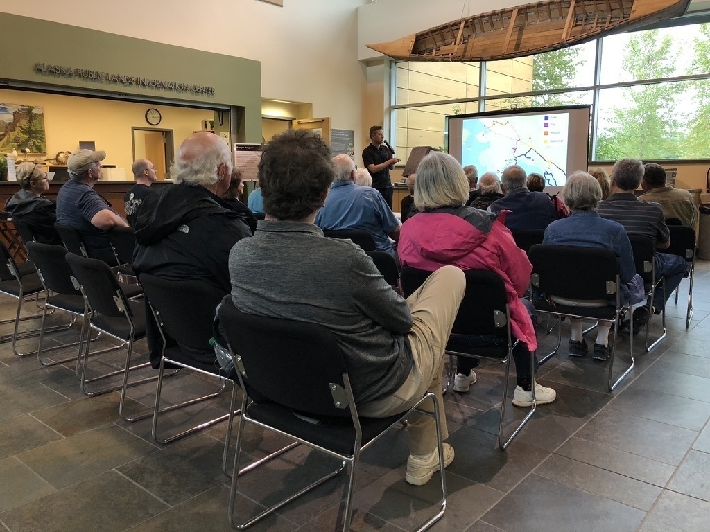
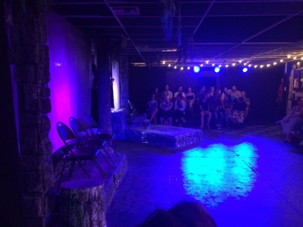
My buddy Mikah Meyer was giving a talk across town, so we stopped over to support him and say hi. We had become friends earlier in the year while he was visiting every national park unit on one continuous road trip.
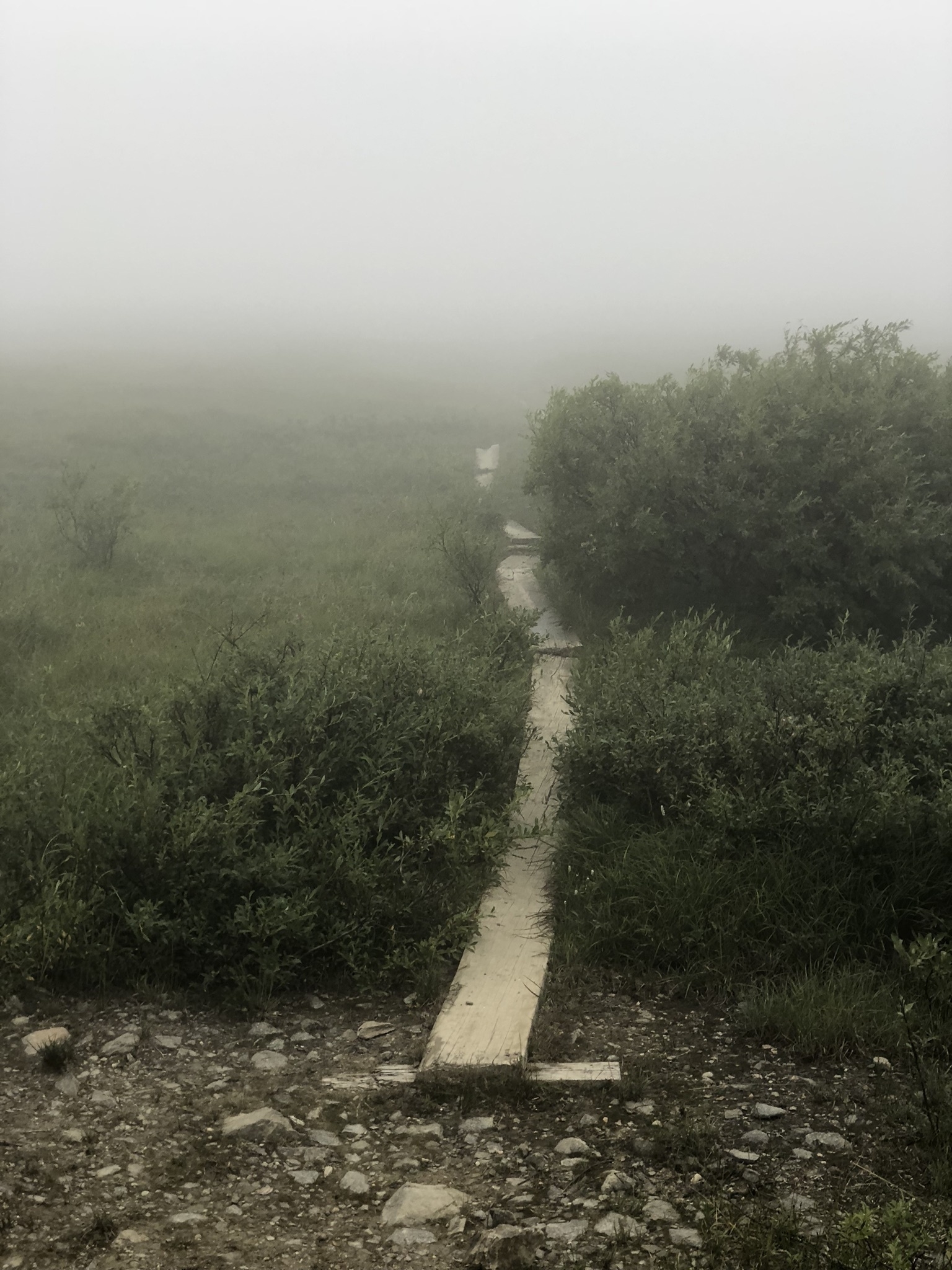
Somehow, the day wasn’t over; but it’s easy to pack in a lot during those incredibly long summer days. With more daylight, we drove a few hours up to Steese National Conservation Area for our Treasured Places quest. It was incredibly foggy (but at least it wasn’t wildfire smoke!) but Jen and I hiked the Pinnell Mountain National Recreation Trail and poked into the NCA while Brian took a nap in the car. I’ll admit that the hike was a bit unnerving, as we couldn’t really see if there were any grizzlies on the trail and didn’t have spray. But, we survived.
Aug 1 2015
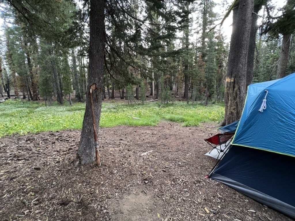
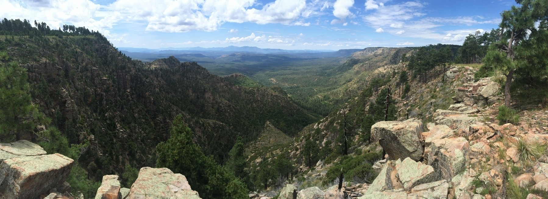
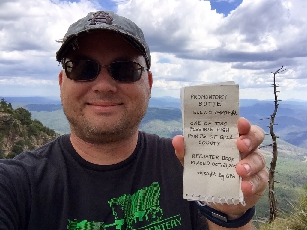
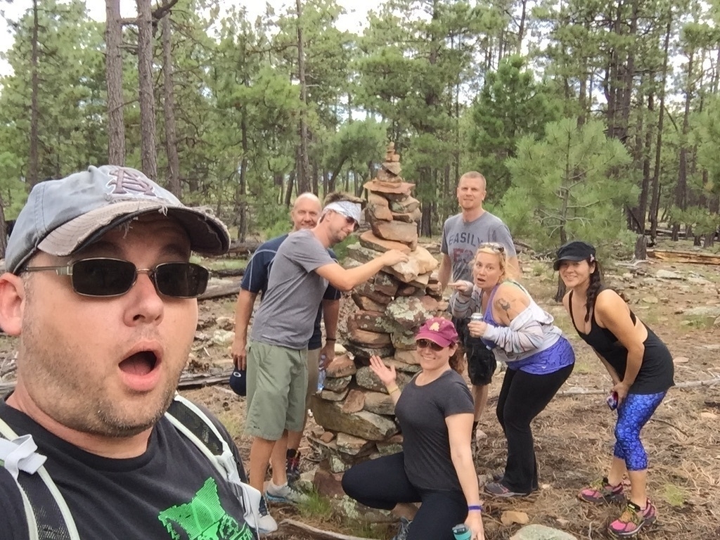
I organized a group camping trip to one of my favorite dispersed campsites along the Mogollon Rim in Arizona. Not a bad view from the site, huh?
While it was great to hang out with friends that weekend, I had an objective in mind. I wanted to mark off the high point of Gila County for my Arizona County High Points quest. There are two along the rim, and this completed the second one.
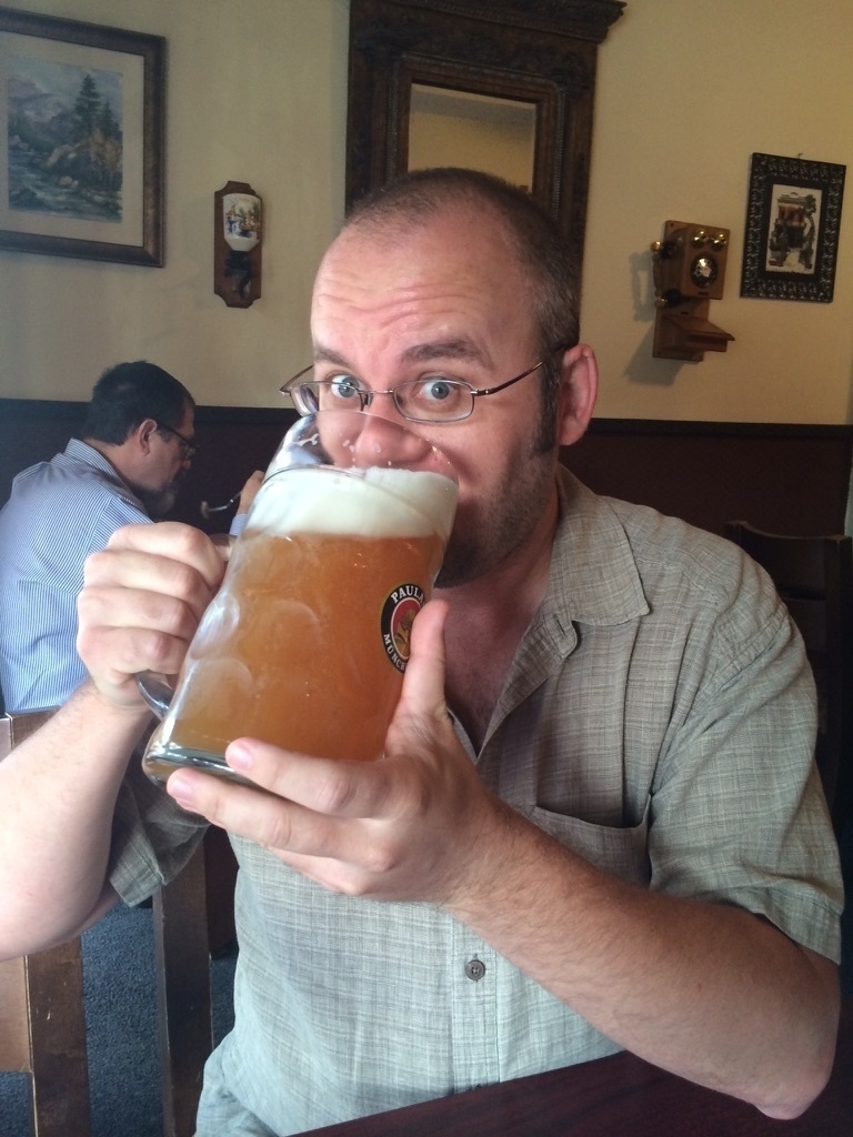
Aug 1 2014
Digging deep here, but I spent the evening grabbing my first litre stein at a German restaurant down the street from a comedy club where a friend’s sketch comedy troupe was performing that night. A fun evening for sure.